
Tasmania - Twist of Fate

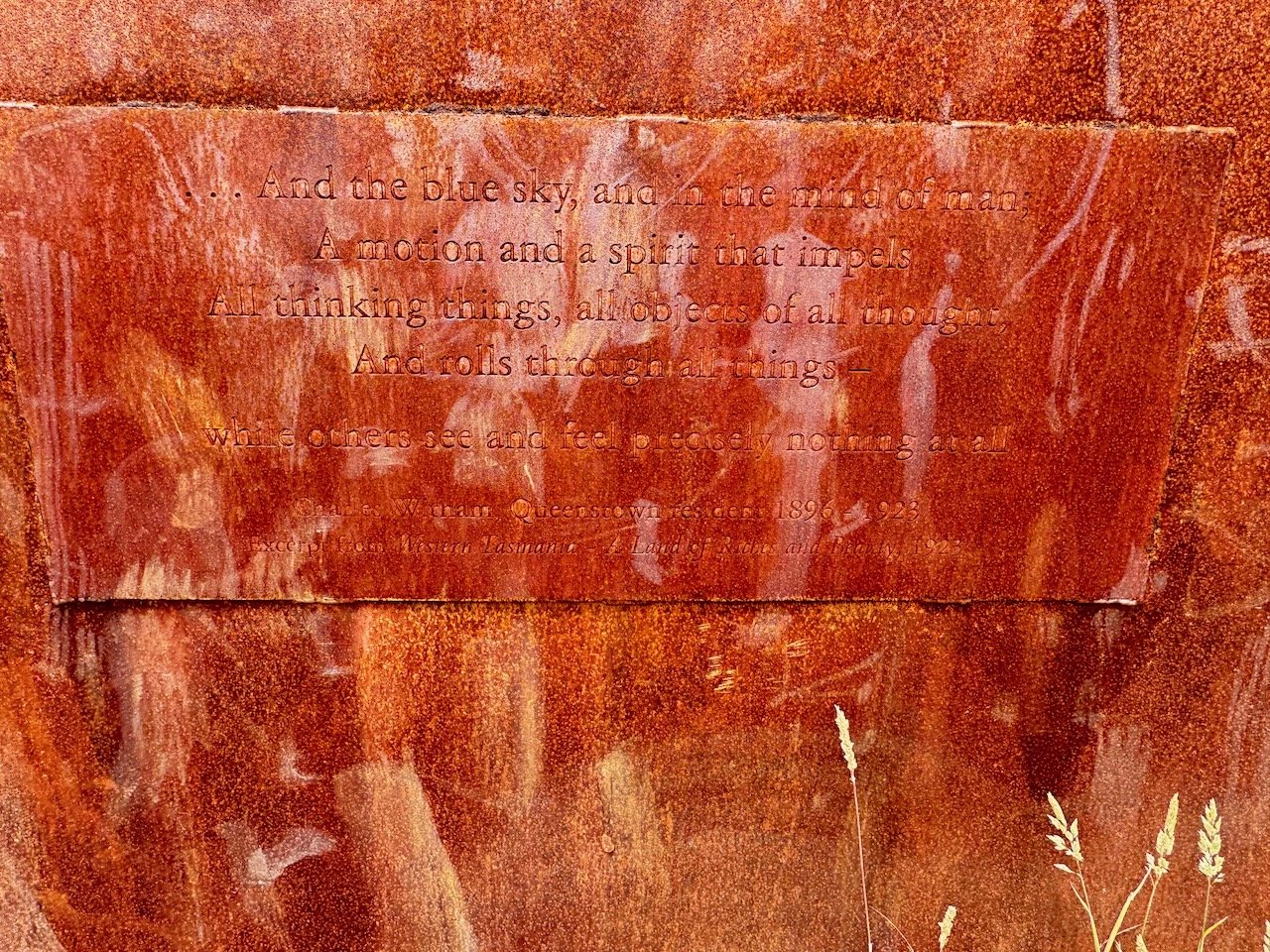
Tasmania Rain Poem - Spot on!
January 25-28, 2024

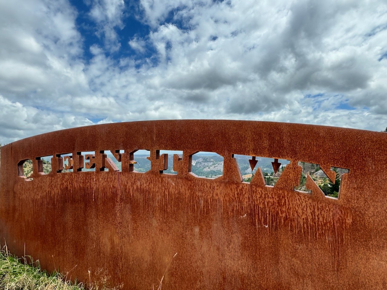
Goodbye Queenstown
After our extended stay in Queenstown, our house was once again condensed into stuff sacks, panniers and backpacks atop our bikes. A couple rain storms had moved through the area in the last week, raising the Queen to the edge of its banks, temporarily overpowering the pumpkin colored sludge with a torrent of tannin-stained water. Another storm was expected to arrive the day of our departure but that morning it looked to be holding off - we hoped at least until we reached the pass above the 99 bends.
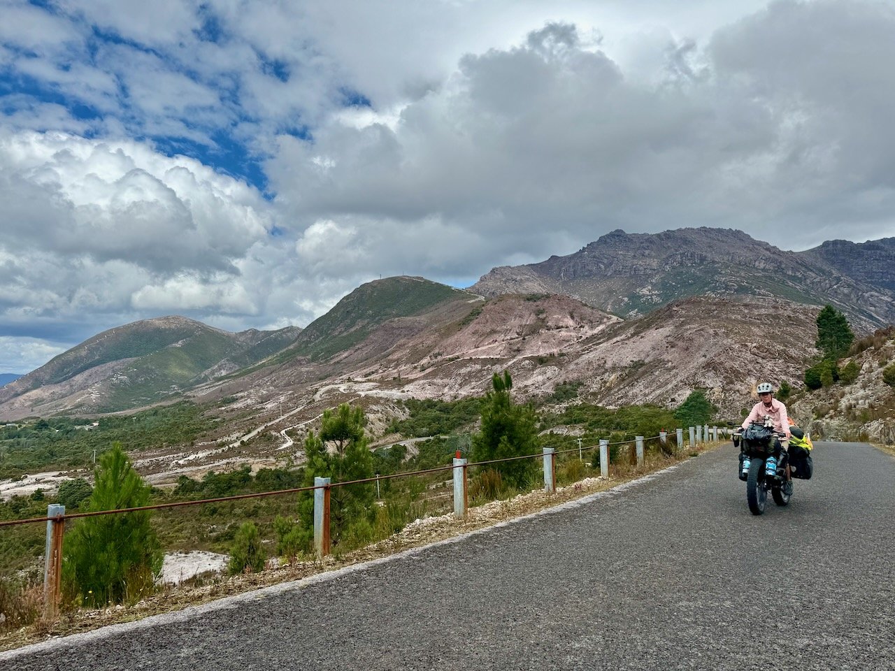
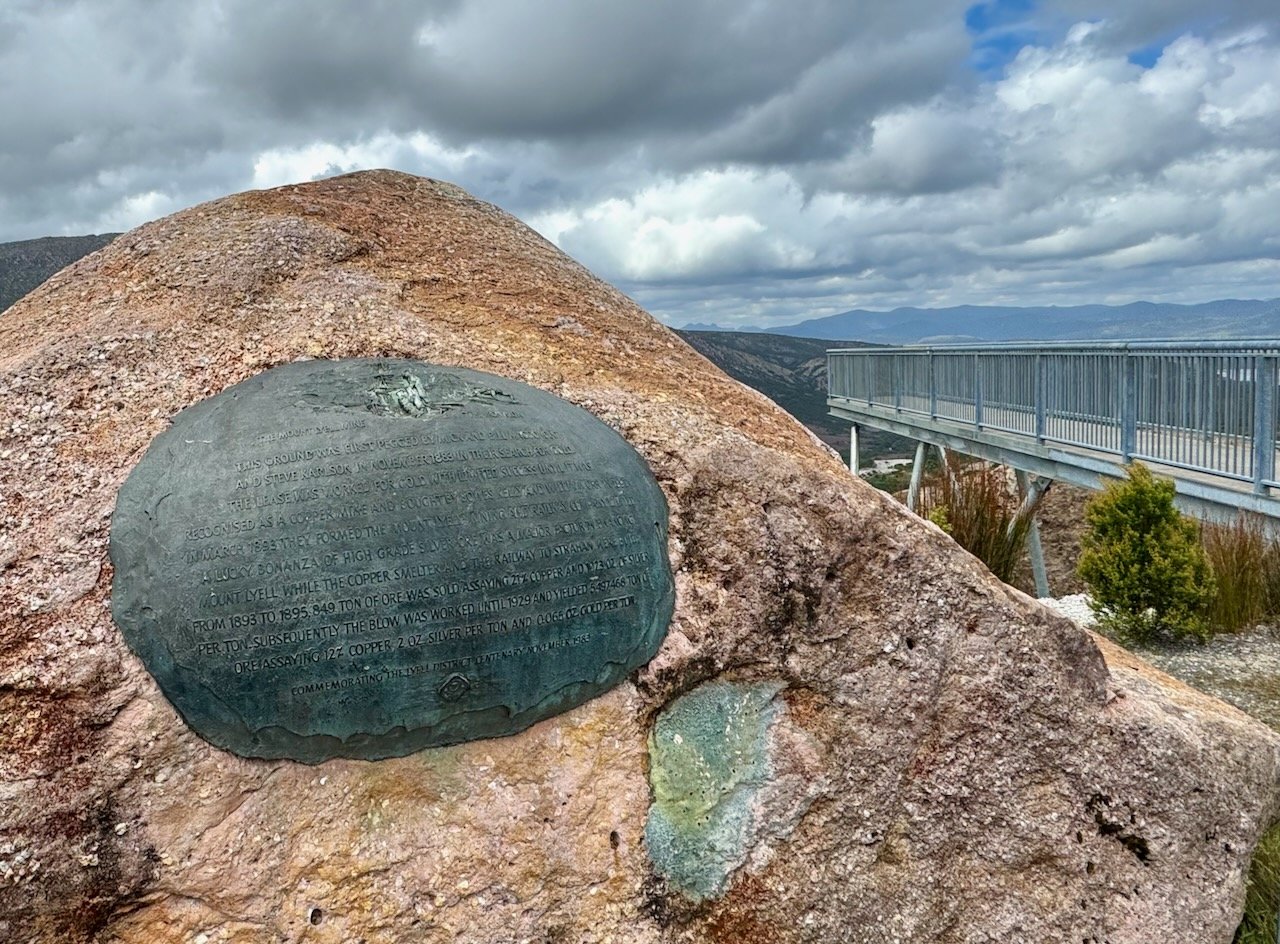
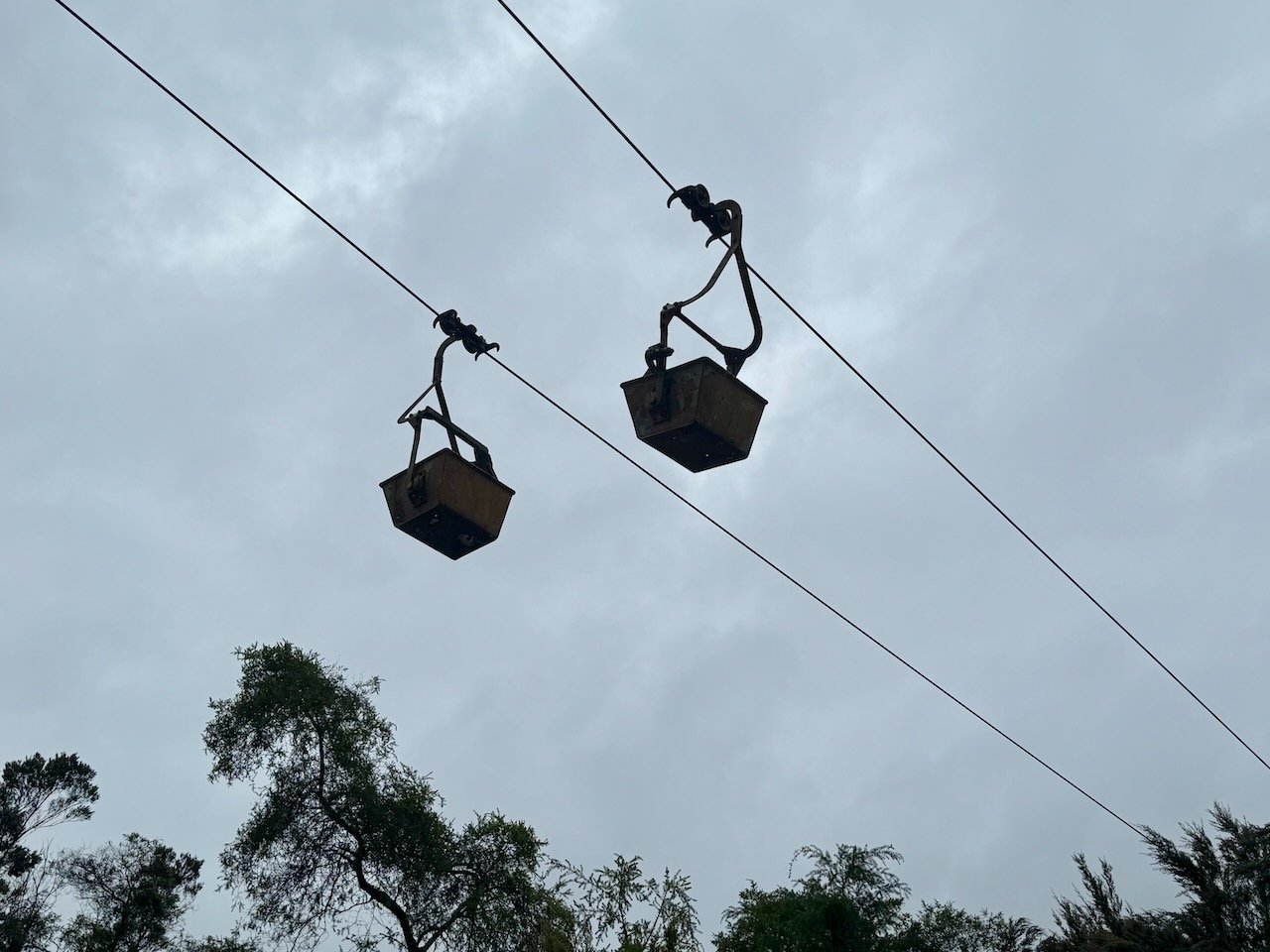
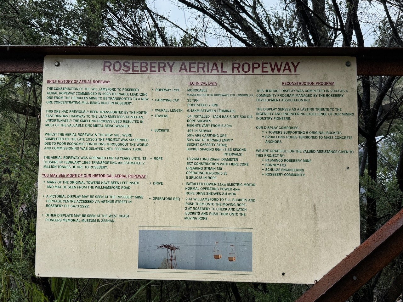
99 bends
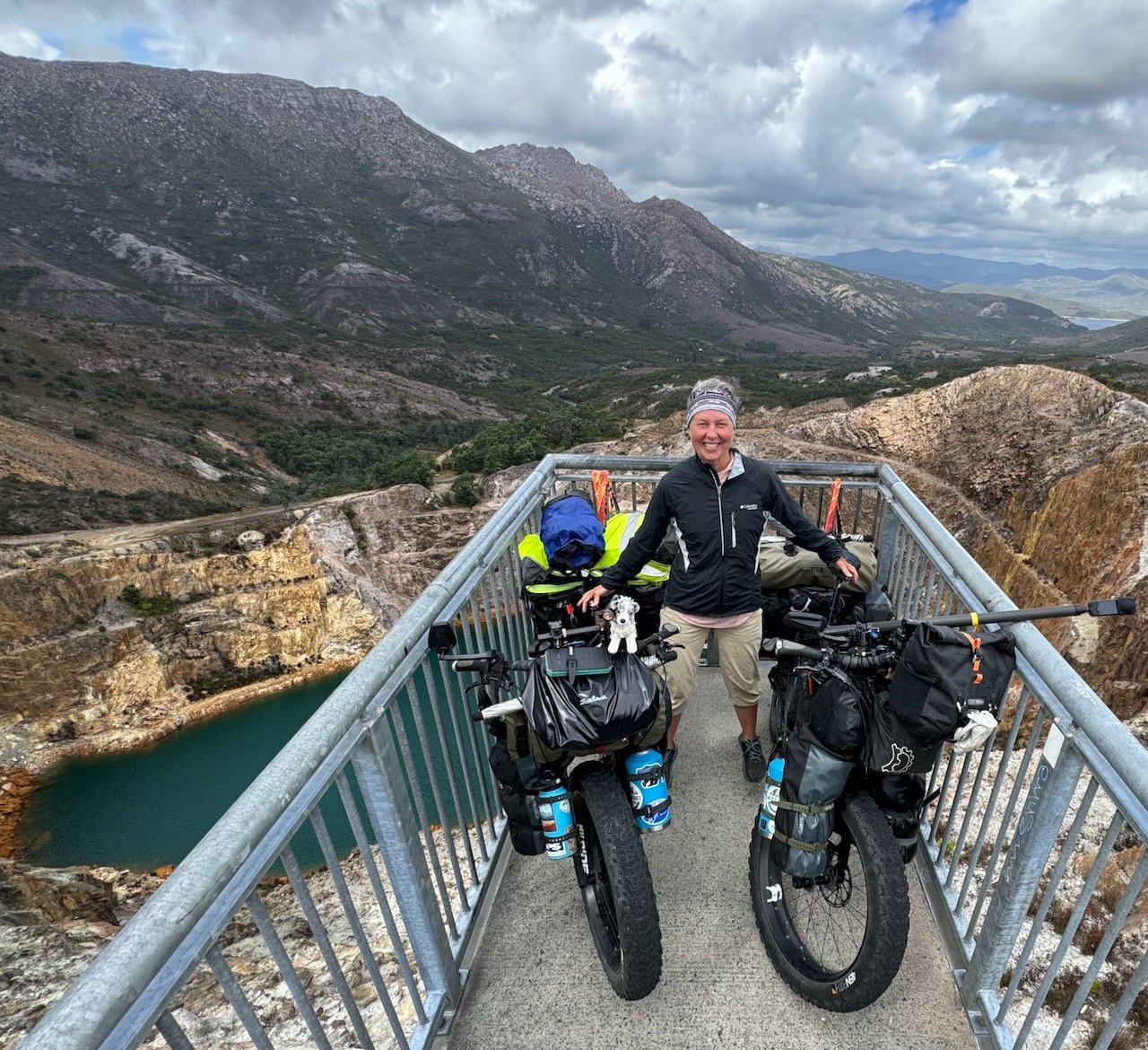
We approached the first incline at the edge of town with some confidence - not only in our new gears, but in the assurance of a young road cyclist we met the day before stating, it wasn’t as challenging as others made it out to be. Indeed there were several pullouts along the way to make up for the nonexistent shoulder, giving us a chance to regroup before edging back onto the road between caravans. As we successfully rounded every corner under our own power, we realized again, how amazing it was that we had our new gears, without them this road would have been a nightmare to navigate while pushing each bike. Instead of dreading every corner, we were stopping to soak in the vistas surrounding Mt. Owen, eyeing the black diamond MTB trails carved into its rocky flanks, the brilliant colors swirled into the sandstone walls alongside us, all while Queenstown slowly faded from view behind us.

99 Bends
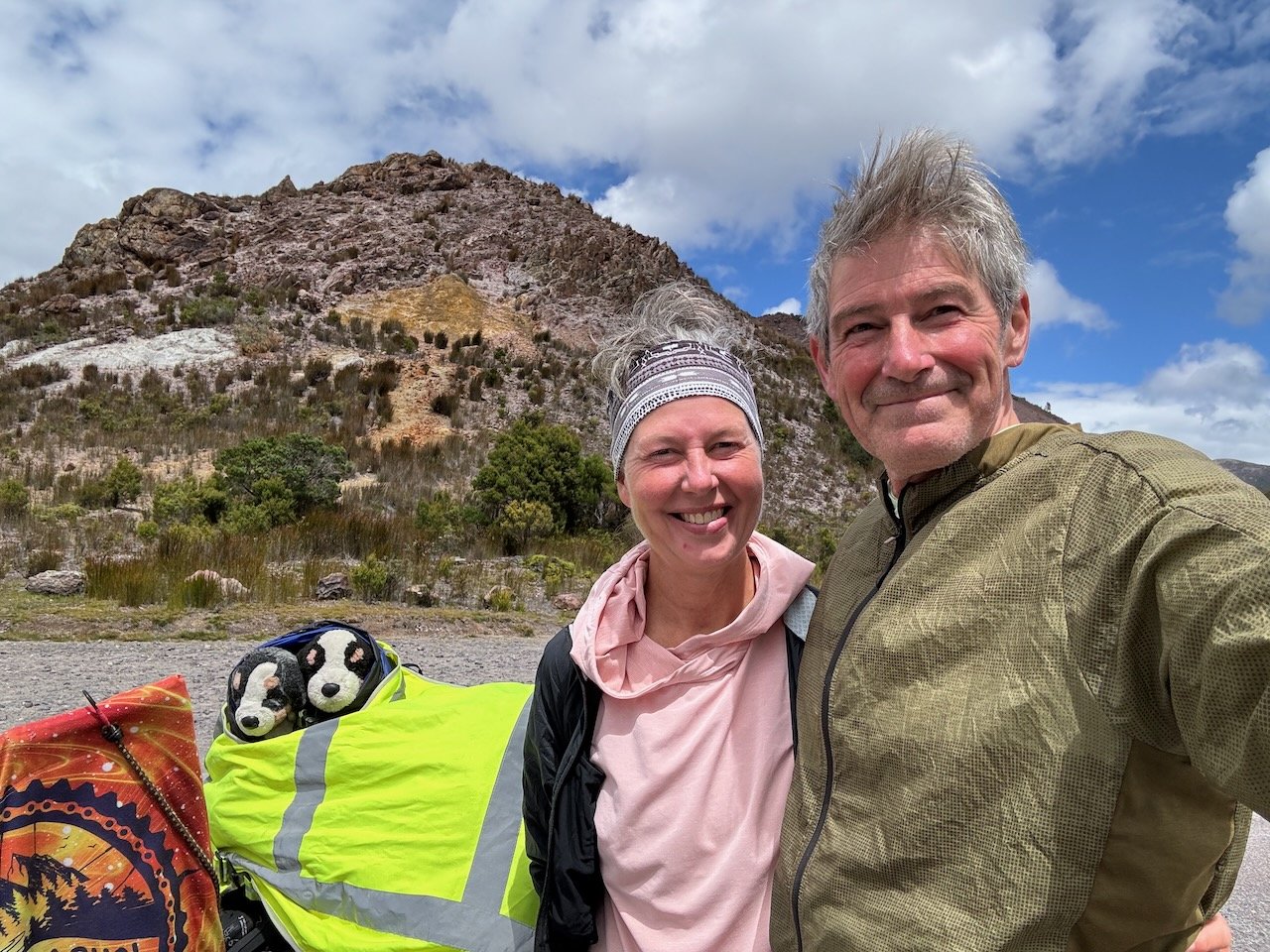
Near the top we caught a glimpse of Horsetail Falls, now reduced to the size of a mule’s tail, several days after the last rain storm. As we made the last few turns to the pass, we shouted out into the wind a truly heartfelt thanks to Aaron at “West Coast Ride” and pulled into the car park feeling elated and relieved.
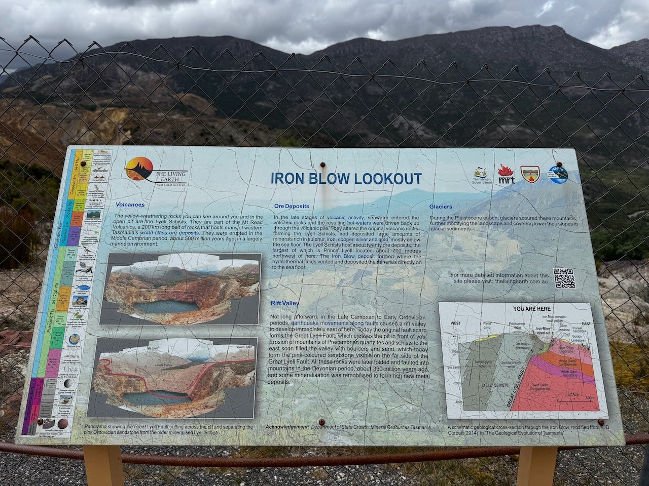
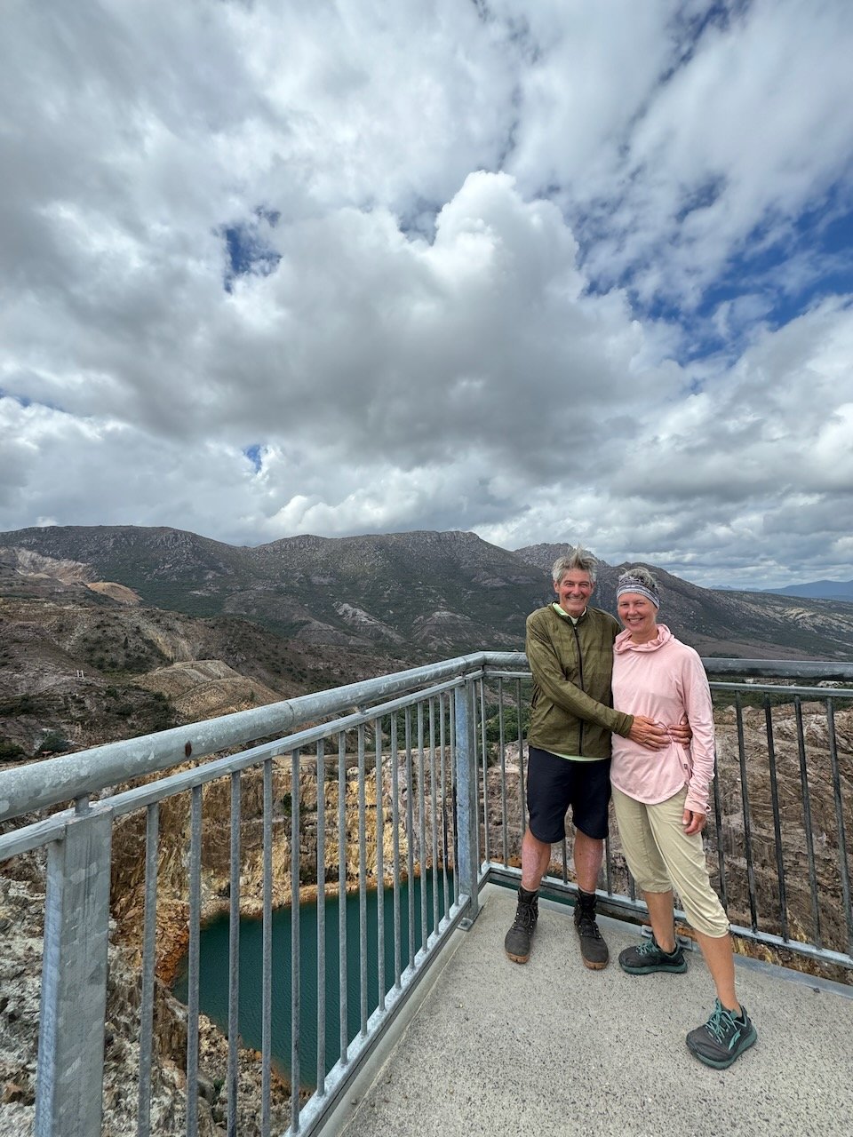
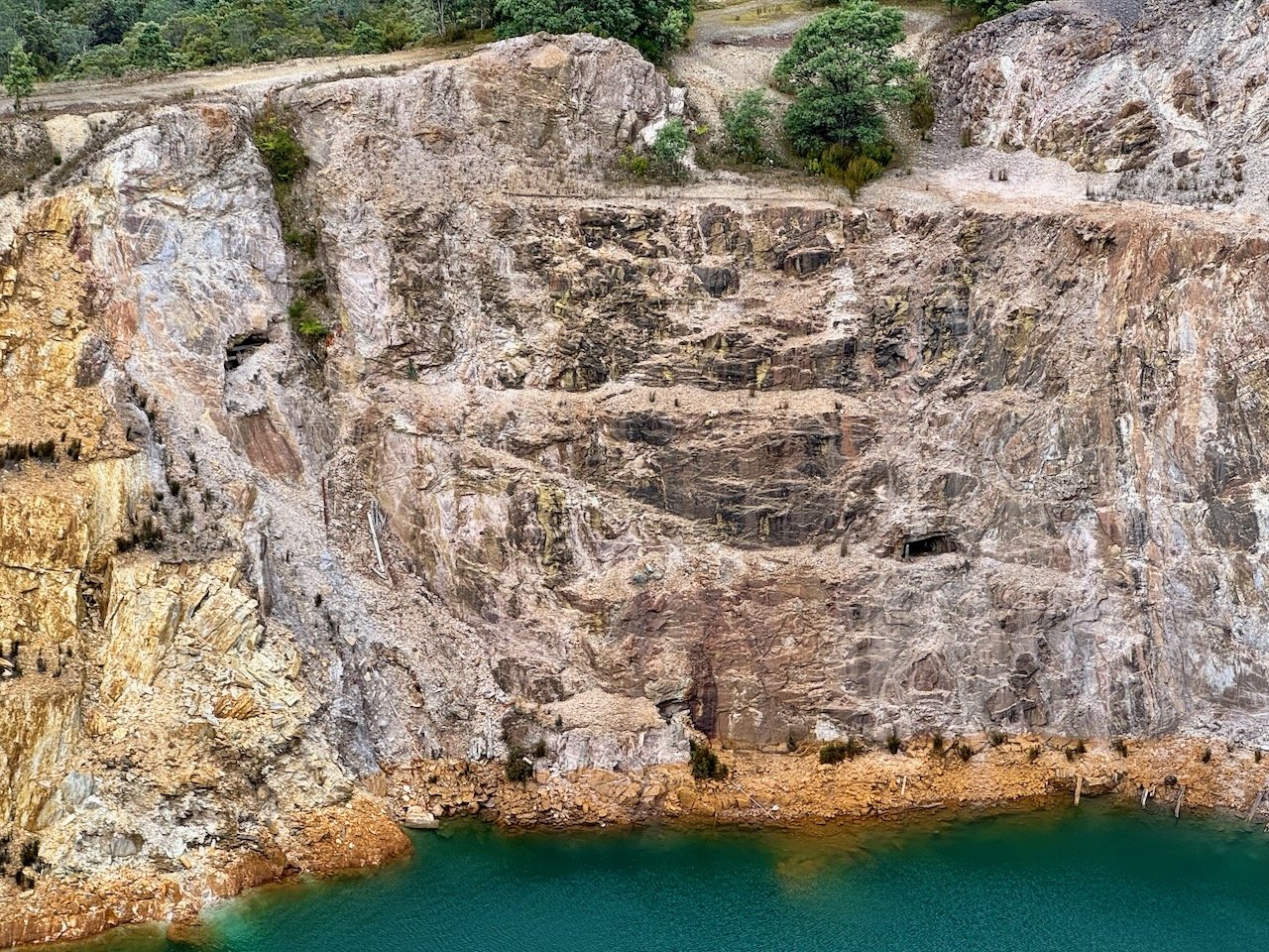
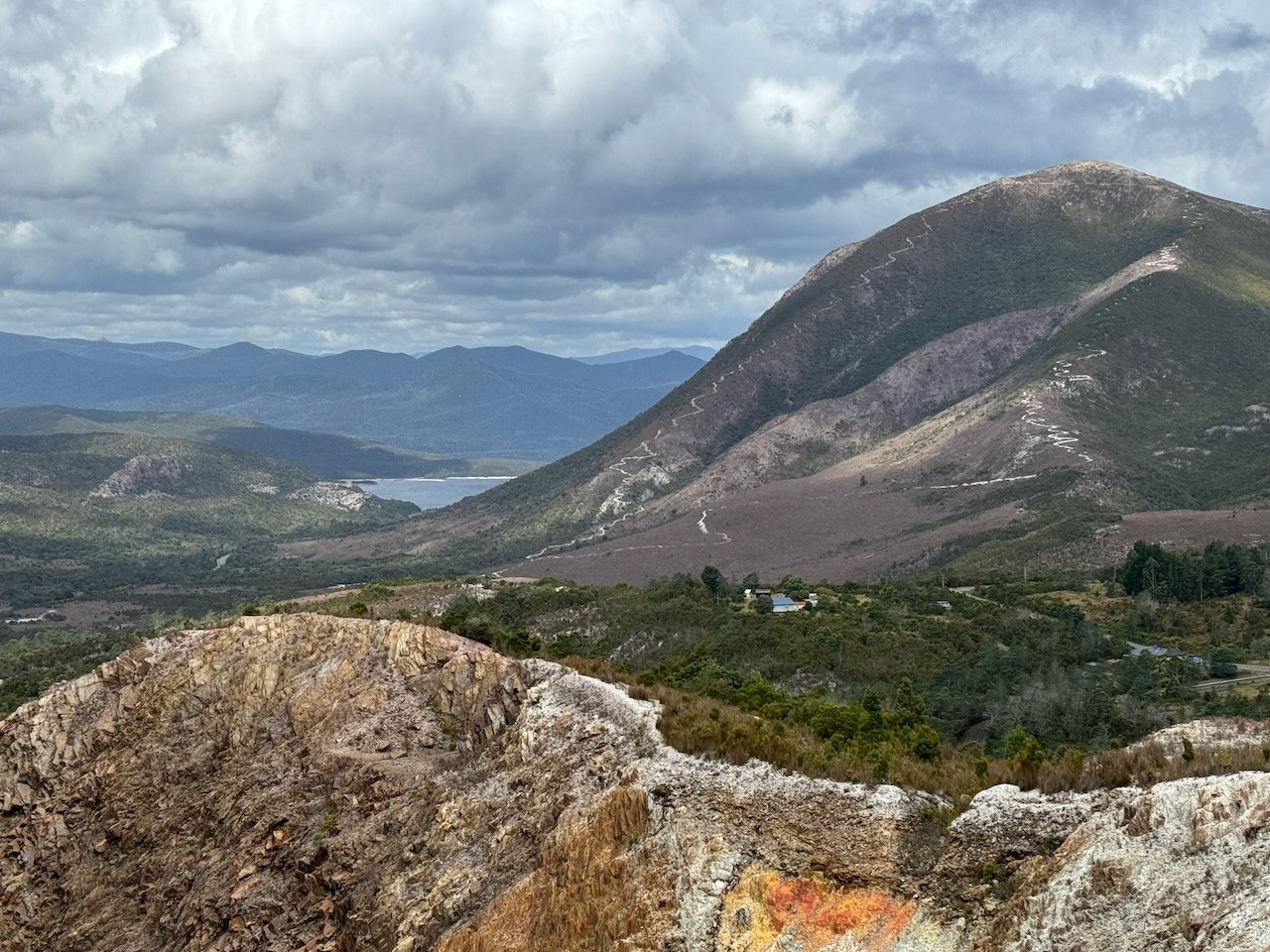
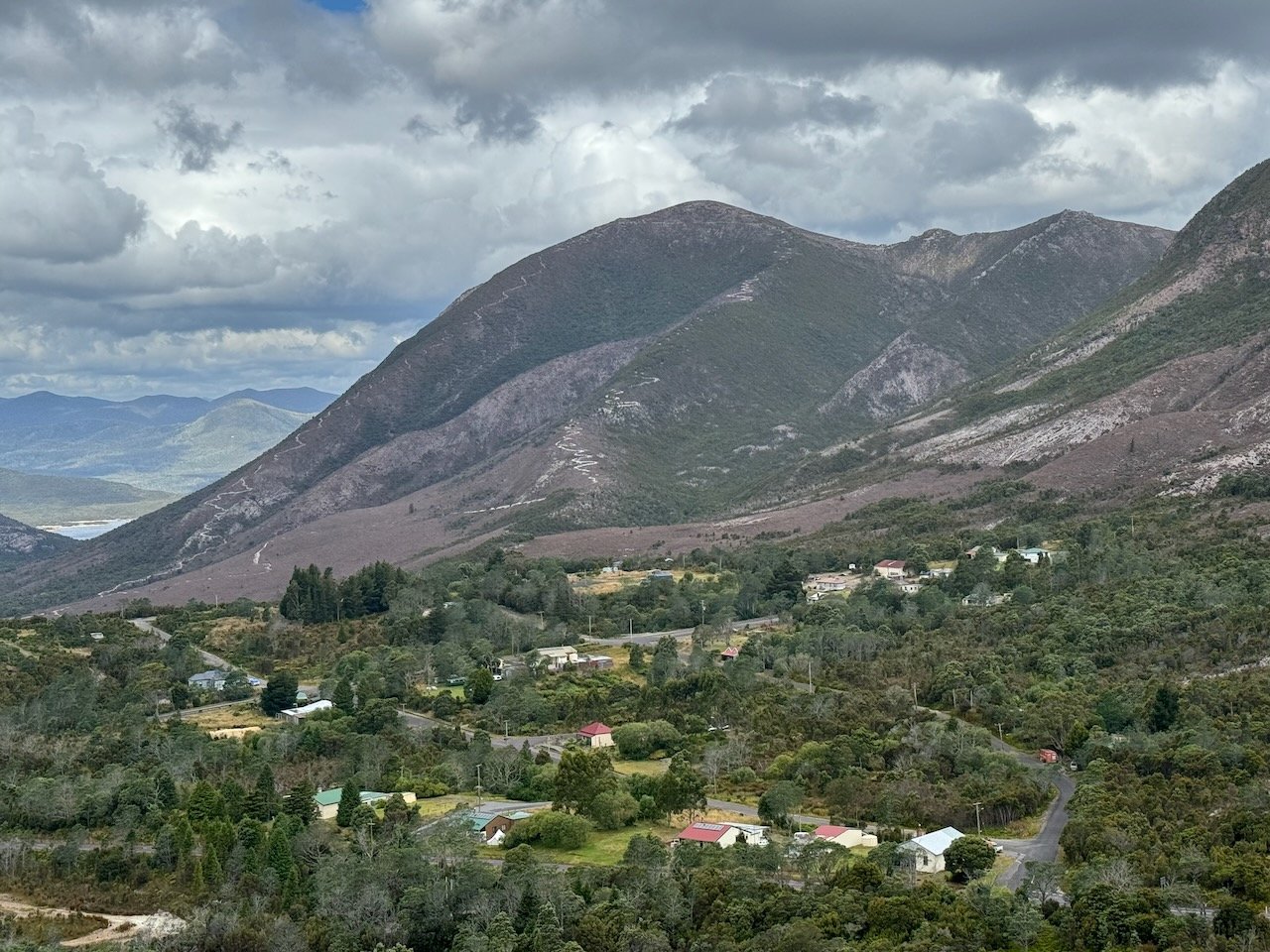
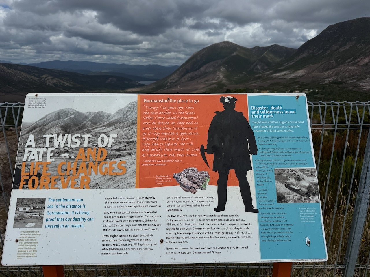
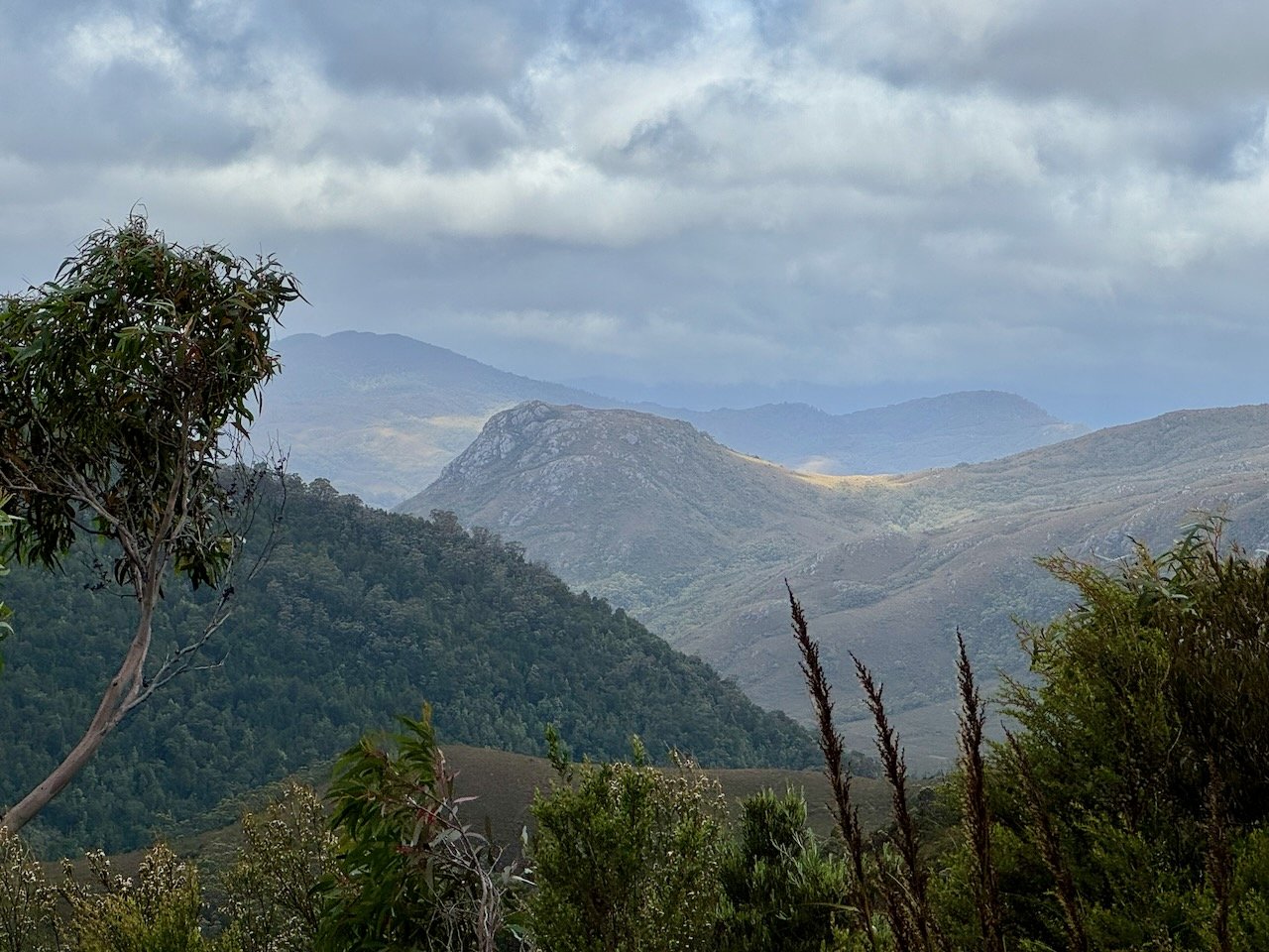
The wind was now whipping through the pass at a furious pace trying fervently to knock us off our feet. After taking a break, sheltered beneath the monument, we headed across the road to climb around the bend and peer into the Iron Blow, another permanent mining landmark etched into the hillside. Peering off the edge of the platform, the turquoise colored pool gave the scarred walls a dramatic, visual appeal. In the distance, views down the valley stretched out to Lake Burbury and directly below the community of Gormanston.

Iron Blow


Gormie Refuge

Fresh Caught Rainbow!
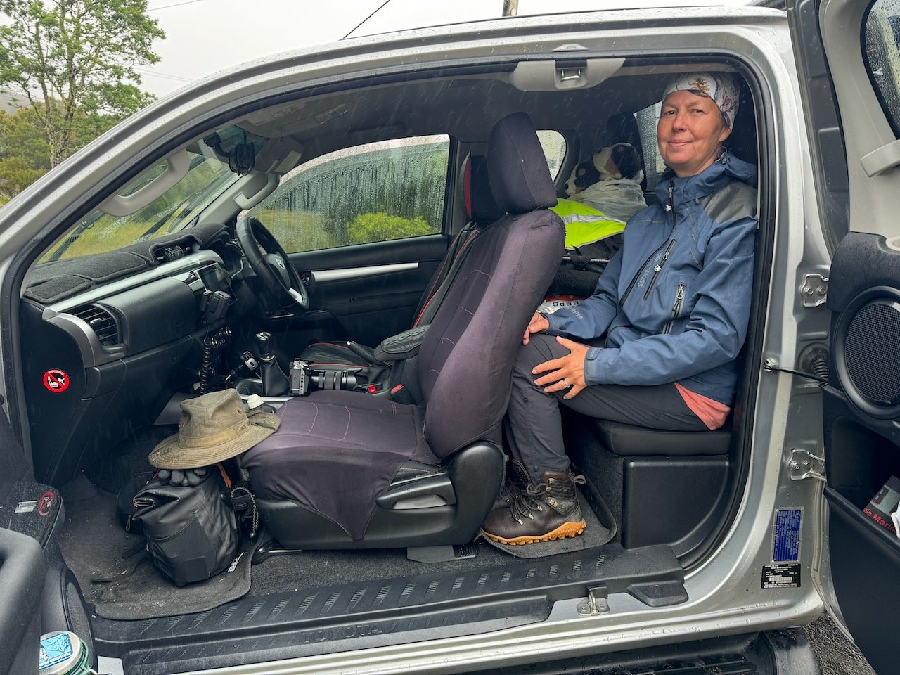
During our stay in Queenstown, we had met a “Gormie” resident, outside the grocery store intrigued by our fat bike setup. He had an e-fat bike and rode down the 99 bends to stop by our camp for a visit. Like us, he was recently retired. Now a proud owner of his own fish shack, content to spend his days trout fishing the many lakes surrounding the area and wood-working in his shed. He welcomed us to come by his place on our way out of town, and surprised us the day before we left Queenstown with a plate of fresh caught rainbow trout filets for our dinner, a delicacy I hadn’t experienced since my childhood days trout fishing with family in Bend, Oregon.
By the time we pulled into his driveway it was nearing 4 pm, the clouds were darkening overhead and the wind continued to whip over the pass and down the hillside. He wasted no time in convincing us to stay in his guest house, assuring us this next weather front was going to be fierce and last at least a couple days. The next day was also “Australia Day” and we had already decided wherever we camped, we were going to stay put to wait out any over-zealous celebrators and avoid any misadventures on the Lyell highway, the only road connecting the West with the center of Tasmania.
Australia Day
Overnight the clouds indeed opened up, and the storm settled in, pelting the metal roof over our heads, as the gales roared through the trees.

Australia Day Flags!
The next morning we awoke to find outside the window, little Australian flags adorned our bikes. We were not to miss out on celebrating Australia Day.
After a breakfast of Vegemite toast, OJ and coffee, we braved the weather aboard his Ute to visit his favorite fishing spots around Lake Burbury and preview potential camp spots along our route. Heading back up the hill, he gave us a history tour of the town - headstones dating back to the 1800s and a few piles of bricks amidst the overgrowth revealed all that was left of the school and the hospital. Yet Gormanston continues to thrive as a small community of 50 residents and two transitory cyclists.
We returned to have a celebratory meal of sausages and beer to make our Australia Day perfectly complete - compliments to our gracious host.

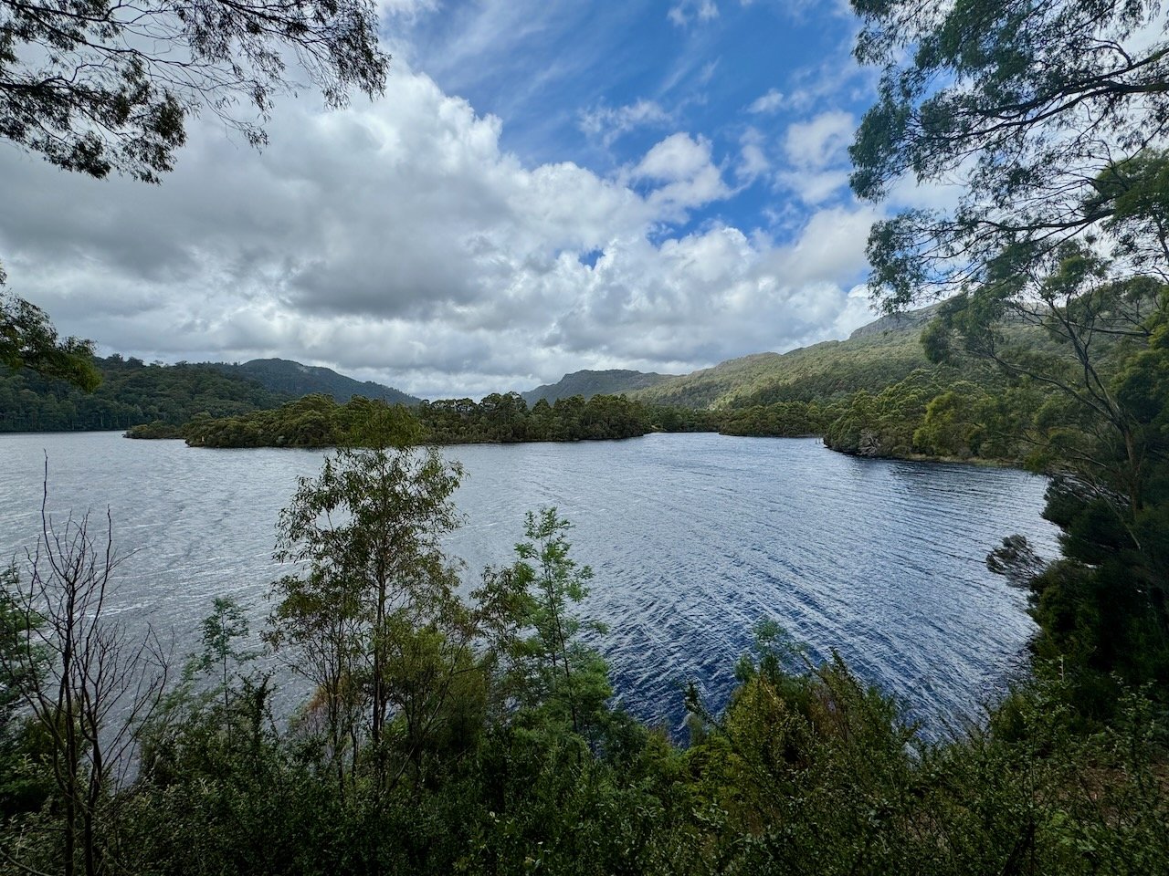
Valley floor Pre-Lake Burbury - interestingly at Mt Jukes lookout, we met a lady born here that hiked this area as a teen just before the damn flooded the valley

Lake Burbury Now - Home of the Trout Filets
The Road Not Taken
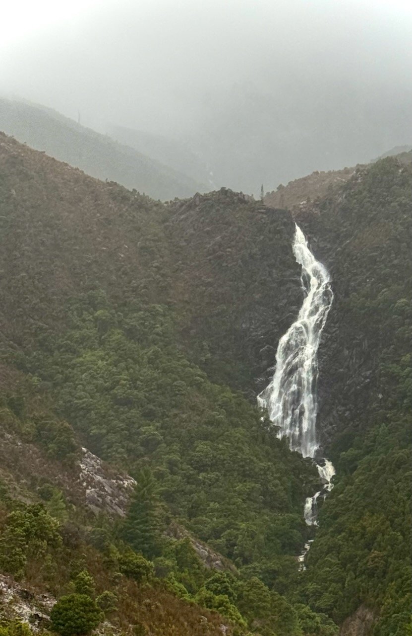
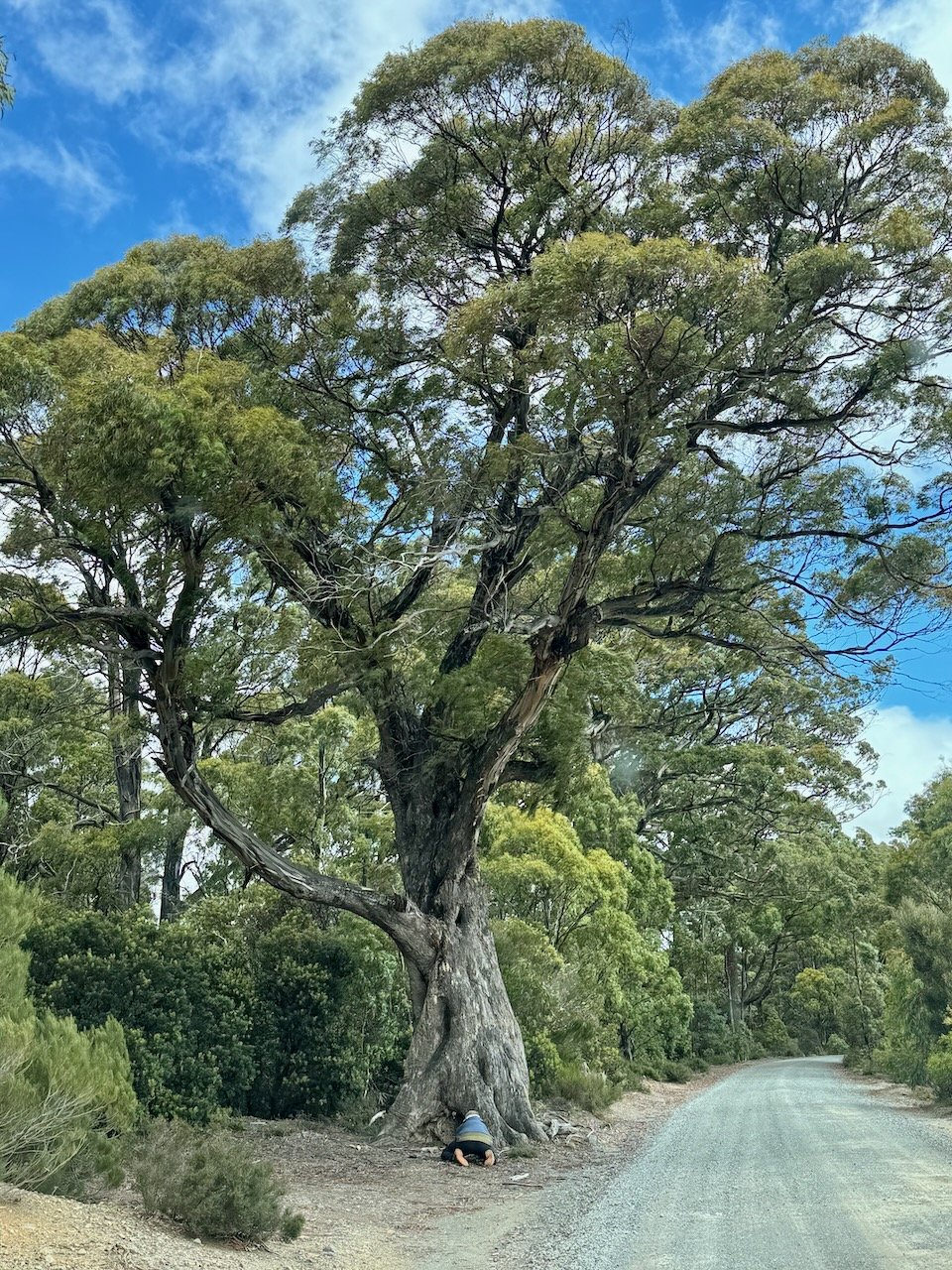
The next day the weather had not improved and our host, now tour guide, had come up with another plan. Today we were to head North, back over the 99 bends, up the section of road we had not taken to visit Rosebery and Tullah. A couple cyclists we met on the Western Explorer went this direction and it had left us curious. As we crossed back over the pass, he stopped so we could admire the now voluminous Horsetail Falls.

Horsetail Falls from 99 Bends - viewing track along adjacent hillside
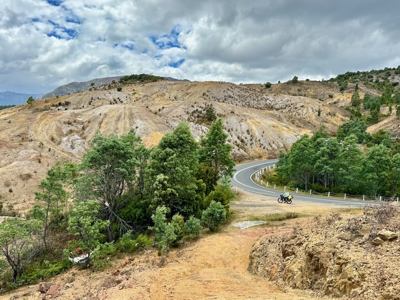
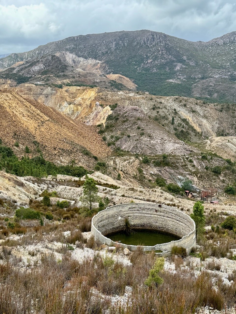
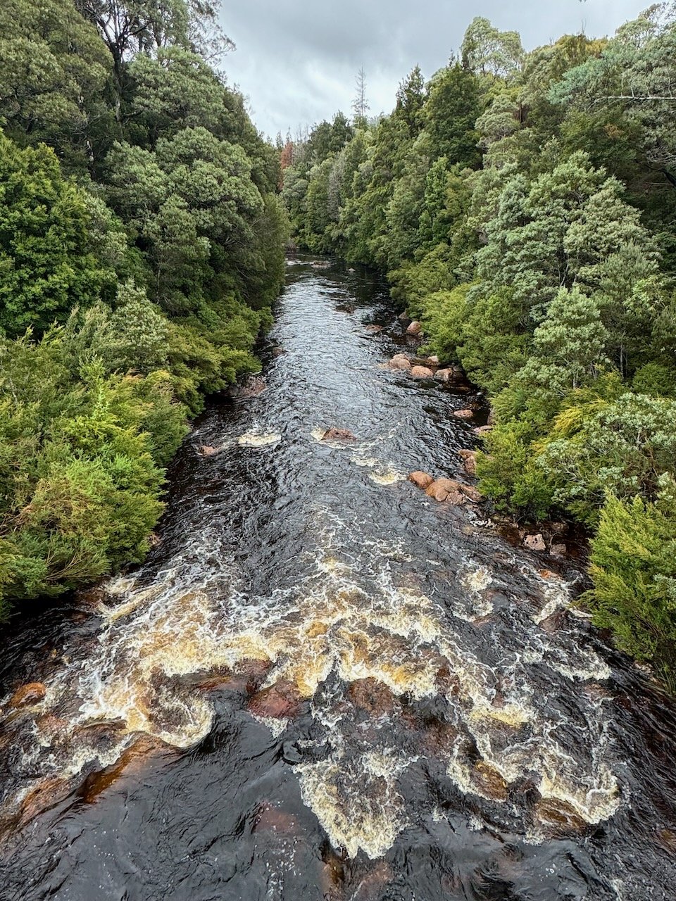
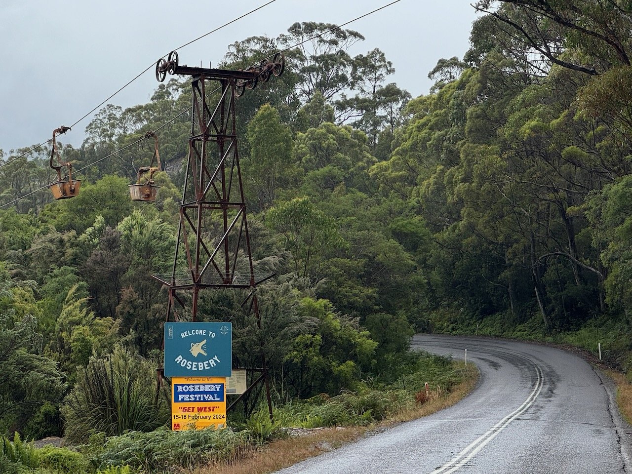
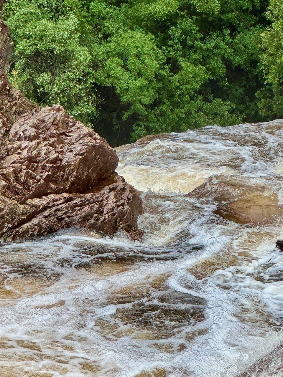
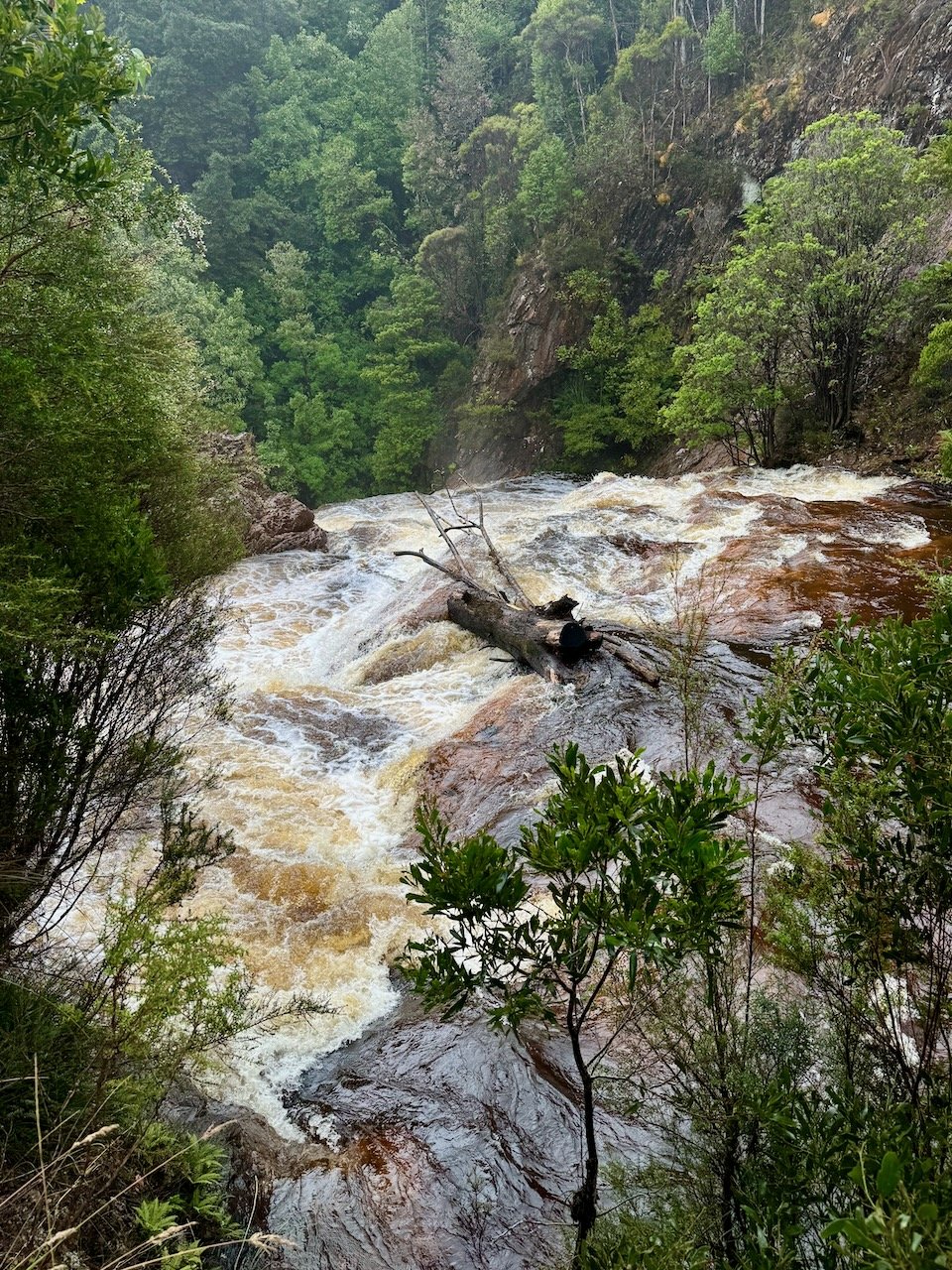
Leaving Queenstown, the road wound up and down through the forest, past streams and sweeping vistas on the way to Rosebery, an active mining town of about 700~ residents. We stopped to check out Stitt River Falls just below the mine and then made our way to Tullah for lunch at a fishing lodge alongside the lake.
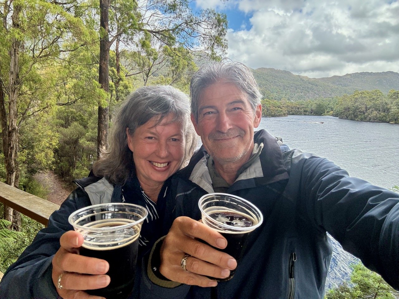
Arriving in Tullah, an even smaller town of ~200, our host was taken aback by the countless caravans and camper vans parked at the corner lot and down the side street up to the lodge entrance. We passed by signs indicating there was an event taking place at the lodge that weekend. He intuitively navigated around to the side lot, wedged his way into a spot and said, “Follow me, we’ll go in the back way. Guaranteed I’ll find someone I know”. As we took a few steps into the sea of people milling about the back of the lodge on the manicured grounds above the lake, almost instantly someone called out to him. Still unsure what kind of party we were crashing - we quickly learned it was a weekend brewery and distillery festival. We were assured by his friends that we could probably just head into the bar and order whatever we wanted and so we did. It was a surprisingly delightful stop, our host reacquainted himself with friends he hadn’t seen in years, while we took in the beautiful views and enjoyed sampling some local brews.
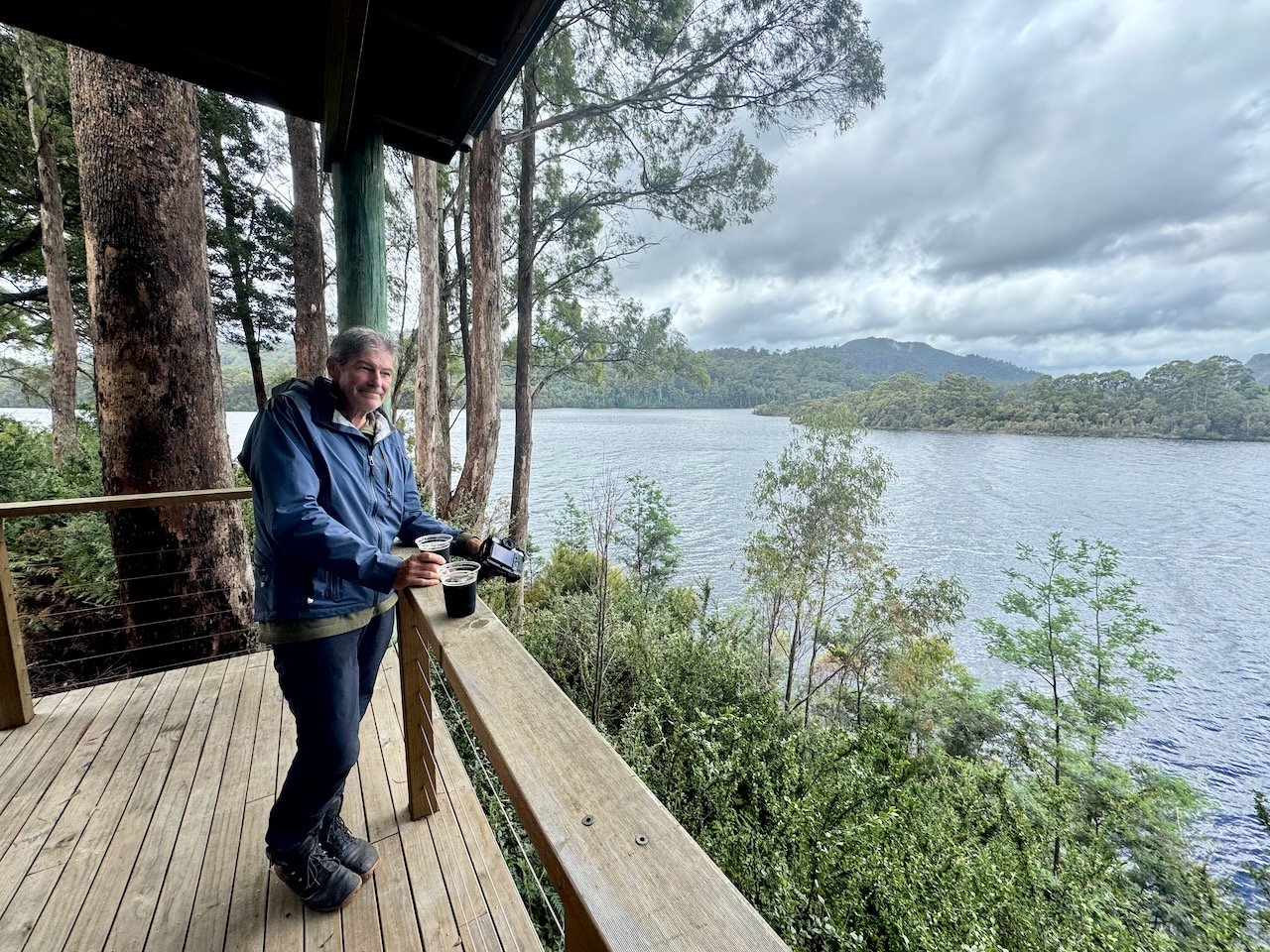

Lake Plimsoll - another good fishing spot
Time Travel
We were hoping the storm would let up enough by the next morning, but instead awoke to a constant stream of beach-type soaking drizzle, wafting in sheets pushed along by a steady wind.
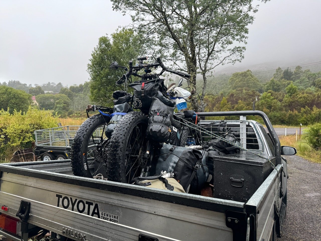
Again, our host had an alternate plan, this time to load up his Ute with our bikes and gear to take us all the way to Derwent Bridge, where we would be assured better or at least improving weather. In Derwent, there was also a local attraction, called “the Wall”, that he was keen for us to experience together. So without much debate, we began loading our bikes and gear atop our four-wheeled time machine. Within hours, we would be 3-4 days ahead, reclaiming the days given over to weather delays.
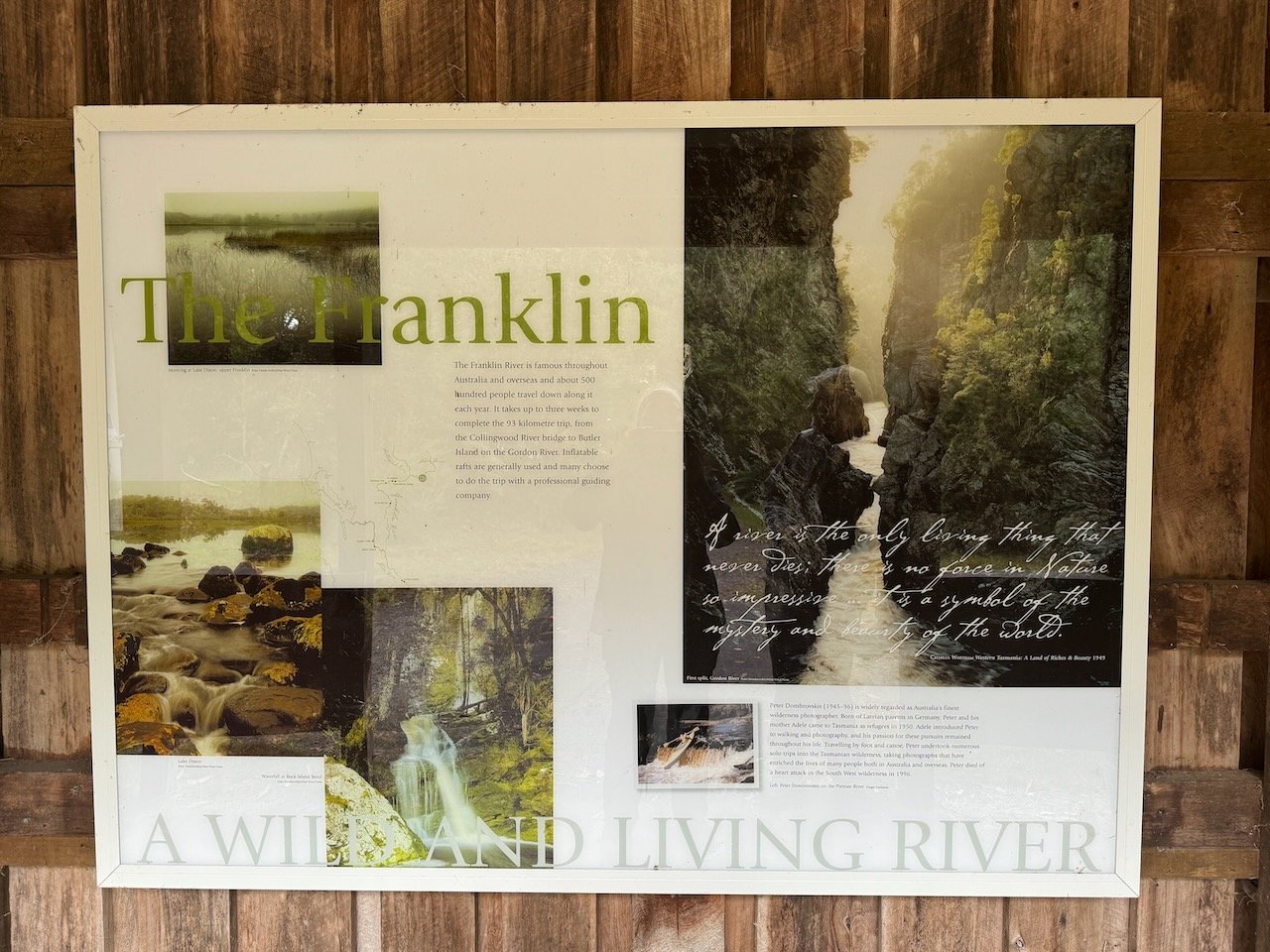
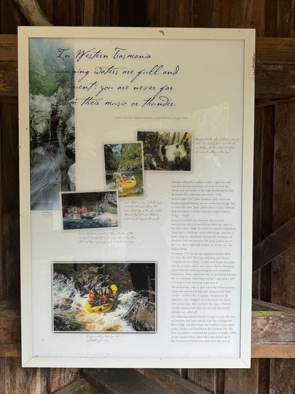
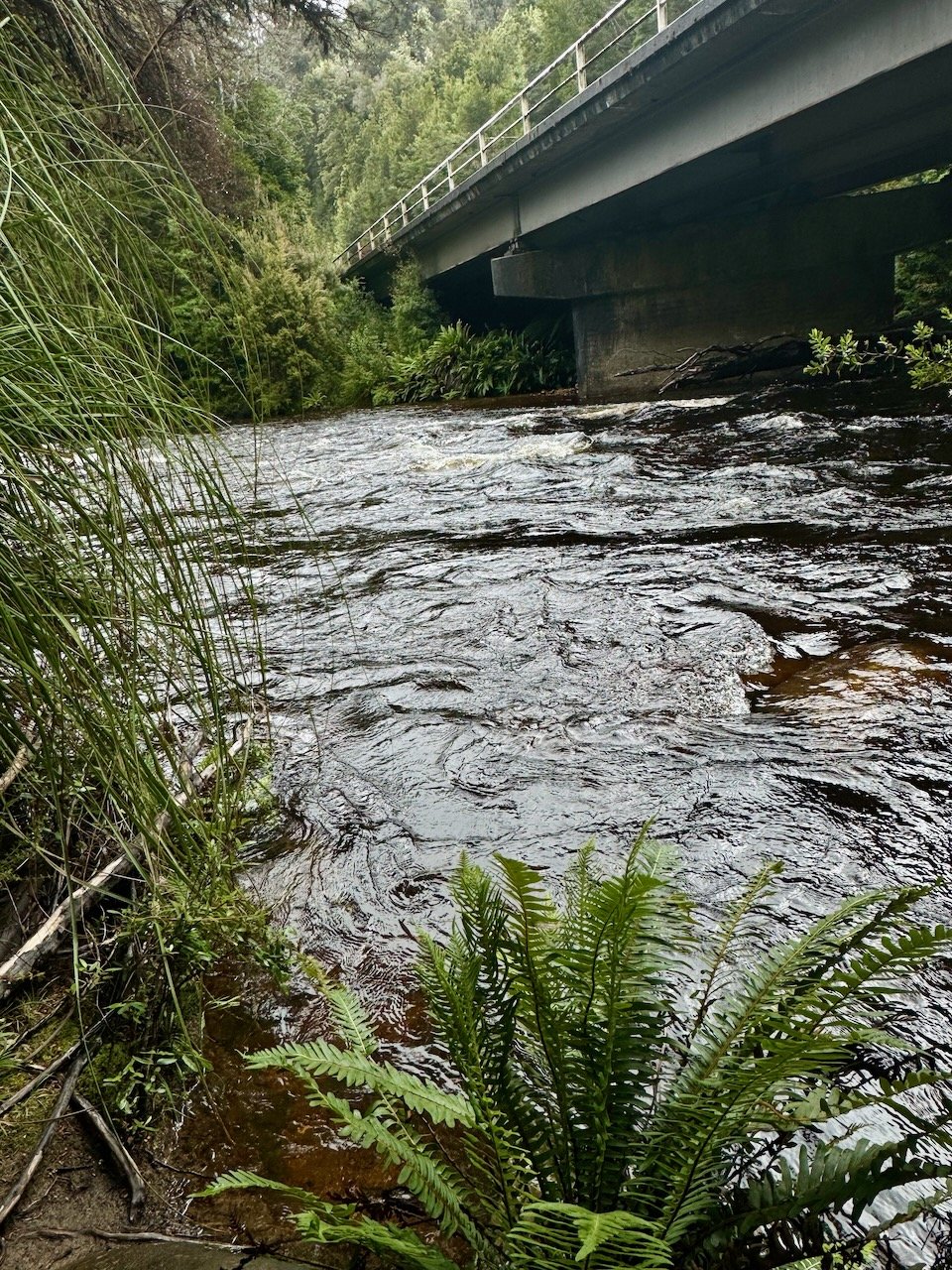
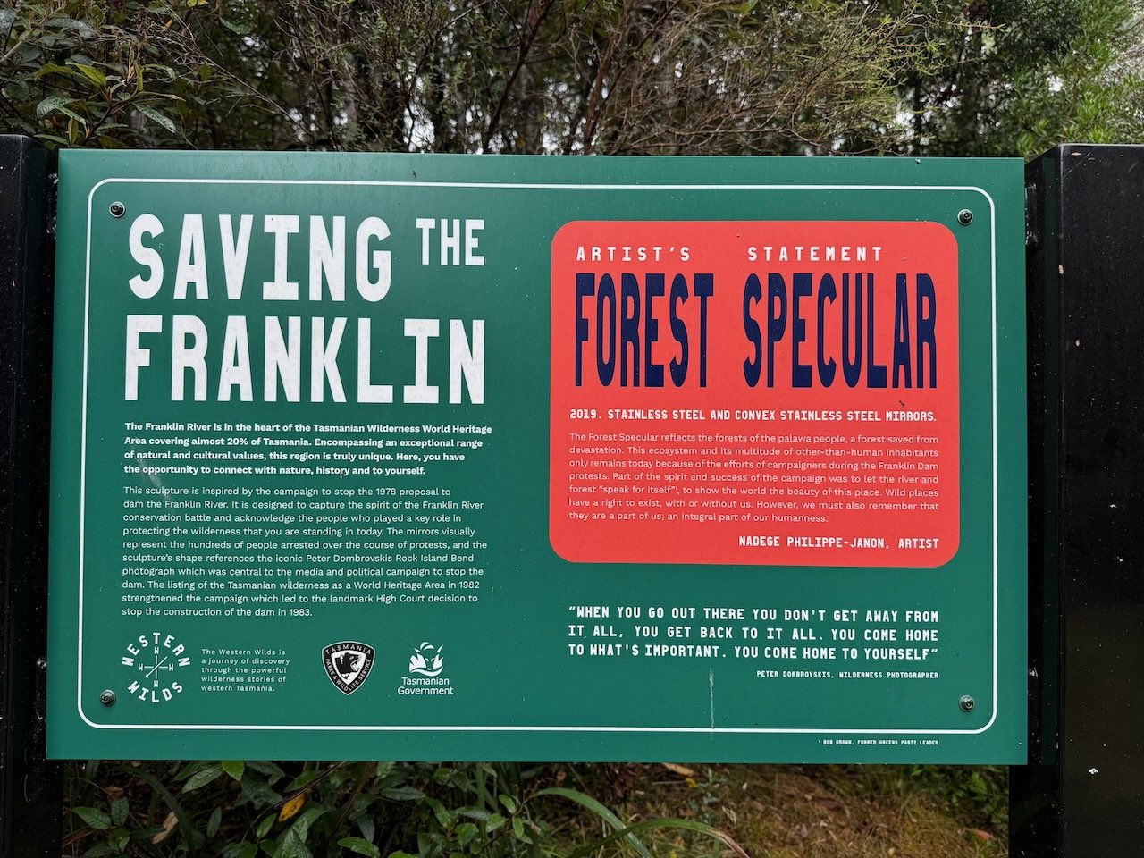
We cruised along leaving the wet behind. After only a few kilometers, the sky began to break apart to let in rays of light and warmth. Out the windows we watched the landscape pass us by at a dizzying pace, trying to imprint the views we would of moved past at our own cadence. Past the forest, into grassy plains we climbed back into forest along a windy section of road into the edges of the Franklin-Gordon wilderness, to reach our next famed river, the Franklin. Pausing briefly at its edge, the tug of wanting to linger longer to explore along its path would have to wait until our return on foot in several weeks time.
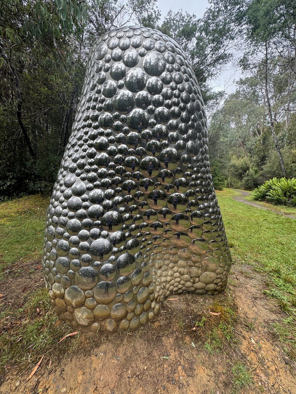
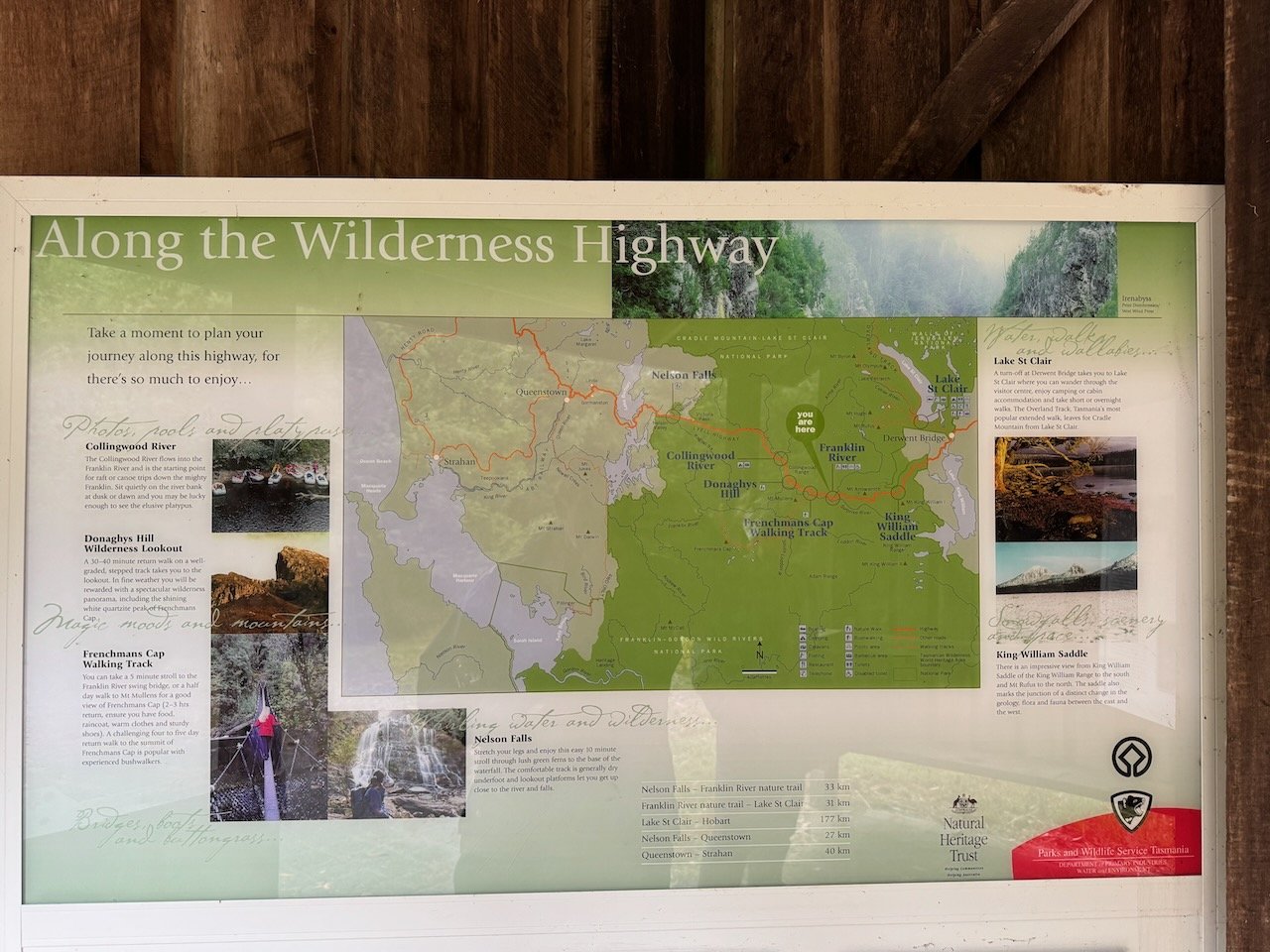
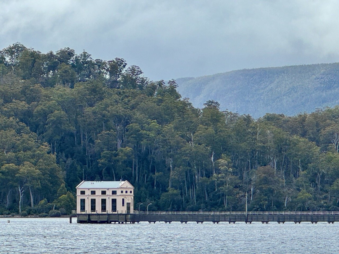
Nearing Derwent Bridge, we stopped to look at Lake St Clair and the picturesque Pumphouse before continuing on to “The Wall in the wilderness” exhibit. Not advertised to the public and simply marked by a road-side sign, “The Wall”, is a wood-carvers dream of mastery. An elongated barn, encloses a 100 meters long, 3 meters high Huon Pine mural with scenes of Australian history and wildlife that are 3-dimensional in appearance. Lining the halls are individual displays of carvings that along with the mural fill the surrounds with an amazing pine aroma. Unfortunately, no cameras were allowed.

Lake St. Clair
Our host then transported us down a gravel road to find a suitable free campsite along Lake King William. After surveying our choices at the end of the road, our gear now strewn about us, we said a most heart-felt farewell to our host. Somehow fate and good fortune were continuing to grace us with the most incredible humans we could not of imagined.

Our Camp at Lake King William - dry & warm!