
To Pelorus Bridge ~ Dec 29-Jan 3, # 16
After finishing the QCT, we had yet to decide on a route down the west coast. Between the Te Araroa (TA) route, the Great Rides App and other notable tracks, our options felt endless, and somewhat overwhelming at first, but our mode of taking one day at a time had not failed us yet.
Havelock
Following the TA route, we took the Link Pathway alongside Pelorus Sound on our way to Havelock, until it jumped the road and went up the steep hillside. Just before town, we were able to join it again, following the board walk across the estuary and on to a track that took us all the way to the marina in the center of town. Havelock is known as the Greenshell mussel capital of the world, and it just so happened, at the first corner we came to, there was a crowd out the door in front of Mills Bay Mussels. We had to stop. A bit delayed, but a perfect post-QCT feed, and our first taste of green-lipped mussels in the form of a croquette followed by smoked salmon and fresh fish and chips.
Before we left on the QCT, we had called ahead to the only caravan park in town and were relieved to hear they had a no-turn away policy for those hiking or biking the TA. After checking the weather, we decided to wait out the rain and leave after the New Year, especially since we had no choice but to ride the state highway out of town. Not as glamorous as last New Years spent in Corinna, Tasmania, this time our camp spot was on TA alley, a strip of grass between the industrial buildings next door and the backside of a row of caravans parked shoulder to shoulder.


After four days relaxing, meeting more TA hikers and cyclists, dodging rain showers, looking for tuna/eel in the nearby stream and exploring the walking track on the hillside above town, we were ready to brave the highway and ride into a new year.


Pelorus Bridge
However, we were still undecided about whether to ride State Highway 6 the next 20 kms at the peak of holiday travel, or try following the TA hiking route on the opposite side of Pelorus river. Most cyclists with full touring setup were riding the highway, but we weren’t convinced. The unknown was whether there was a way to navigate the last few kilometers of the TA route before crossing the swing bridge to reach the campground on the other side of the highway.
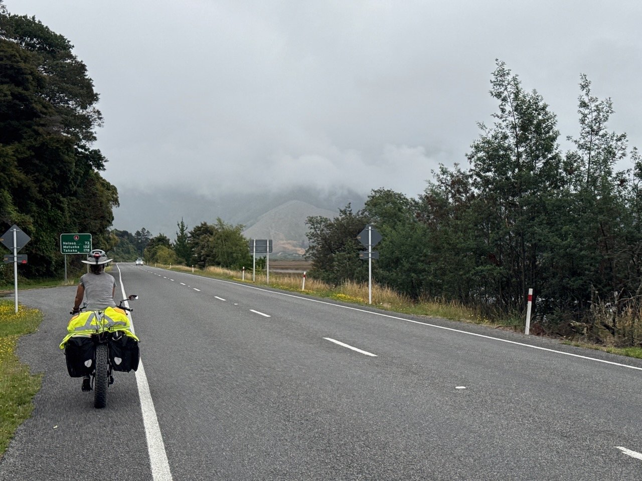
Leaving Havelock, the only option for all hikers/cyclists is to take the highway for the first 3 kms up to the first side road. By the time we arrived at the intersection, we were already mentally done with riding a narrow shoulder and constantly looking behind us for the next truck or caravan, as well as in front of us for oncoming vehicles, attempting to pass others on the right, presumably in a rush to make the ferry in Picton. We veered off onto the gravel track with a sigh of relief knowing our only “traffic” would be the two-legged kind traveling either direction. The gravel road wove its way along the hillside at the edge of the farmland blanketing the entire river valley. As we caught glimpses of the busy highway across the river, we knew we had made the right choice.

Leaving Hwy 6 for the back road
After 11 kms of peaceful riding, we arrived at the final vehicle bridge over the river that would take us back to the highway for the last 7 kms to the campground. As we looked at the caution sign posted at the entrance to the farm road and discovered the TA hiking route crosses occupied cow paddocks, as well as stiles over fences, before reaching the swing bridge, the obstacles proved too daunting, and the dreaded “paved road of least resistance” finally won out.
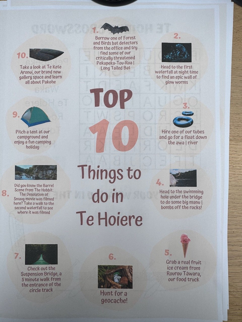
We arrived unscathed at the parking lot next to Pelorus Bridge by mid-day just as the rain set in and were amazed to find a real food cart with a menu full of hot comfort food options ~ not just pies and toasties here! Not only did we get a hot meal on the patio whilst the worst of the rain came down, the reception desk also loaned us a bat detector to look for long-tailed bats! Despite our best efforts, they evaded us entirely, maybe due to the weather.


Pelorus Bridge Scenic Reserve certainly took us by surprise. We spent some time along the river before walking along one of the many tracks through a mature native forest that felt just like the first section along the Timber Trail - untouched and filled with fairy-tale magic. With more rain in the forecast, we decided to see if we could stay another night. Fortunately, they had a space in the overflow section still available.
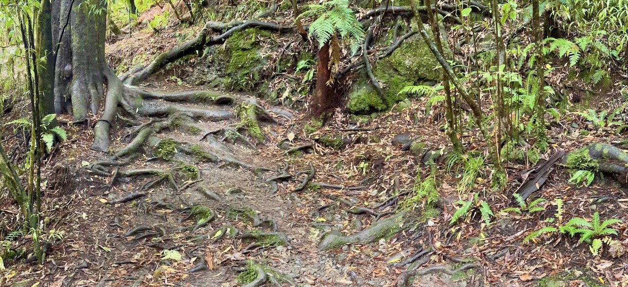
Tawa Walk

Pelorus River


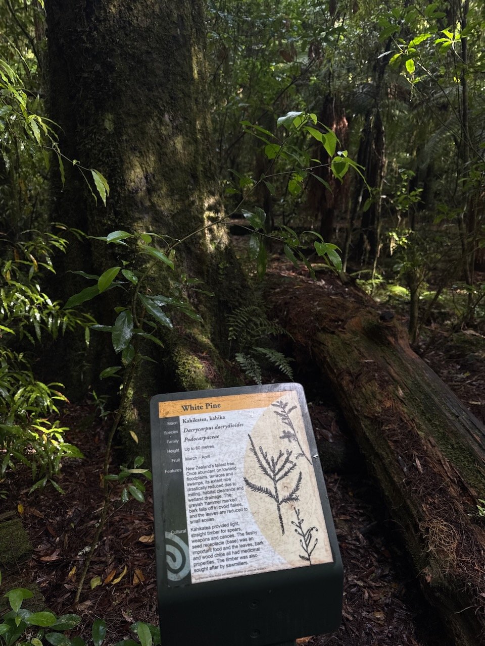


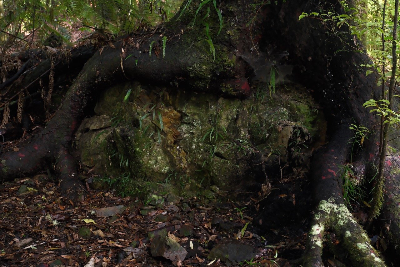


Podocarp forests continue to amaze us
The next day, I walked up to the second waterfall, another Hobbit film location, while Nivaun made his own version of barefoot sandals.
Elvy Waterfall walk
Fairy-like steps


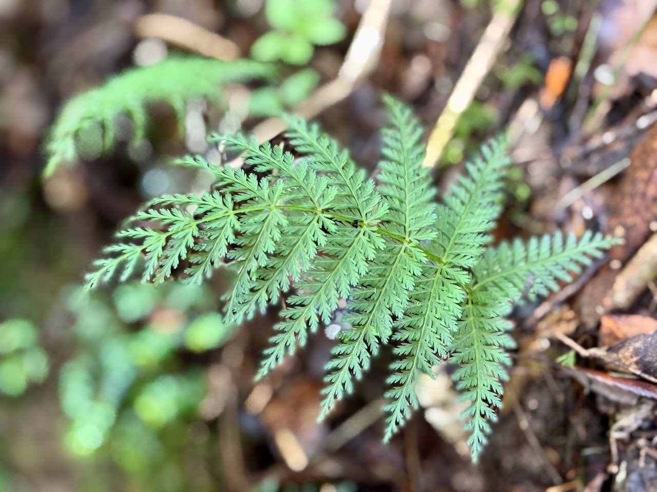


Elvy Waterfall
Gear Repurposing
After months of searching, Nivaun had given up hope of finding anything close to a barefoot sandal to replace his worn out Zeros. Instead, his ingenious design was born from the remnants of one of our bike tires replaced in Wellington. As soon as he shared his prototype design, the bike packers we had met along the way all wanted to know if he was taking orders. A possible future retirement income - who knows!


By late afternoon, the next round of rain showers came through. Even though it was the start of summer, spurts of spring-like weather kept rolling in. Locals were complaining, but secretly I was celebrating every cloud-filled day - riding in the summer heat was yet to be realized and I was so grateful!


